
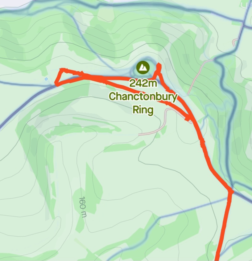
I had to open this blog with my favourite spot on the Downs, the mighty Chanctonbury Ring. This 242m high Marylin sits just outside of Washington, West Sussex, had significance for bronze age, iron age and early Roman peoples. The ring of beech trees, first planted in 1760, make this site clearly visible from its exposed ridge across this area of the Downs.
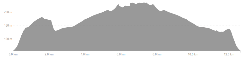
| Route length | 13.5km |
| Route time | 3 hours |
| Accessibility | Some steps access and narrow paths on Cissbury Ring, but all paths leading to and up Chanctonbury Ring are clear and either gravel or tarmac. Exploring the very top of Chanctonbury Ring is off-path. |
| Challenge rating | 2/5 – Mild challenge An initial short but steep walk up to Cissbury Ring, but otherwise gentle and family-friendly. |
| Dogs? | Dog-friendly route, but they must be kept on leads – especially on Cissbury Ring due to roaming horses and other livestock. |
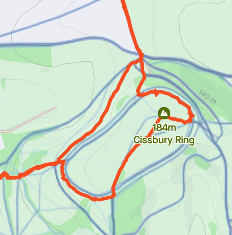
This 13.5km route starts at the larger historical site of Cissbury Ring, and takes a long, gentle walk up to the South Downs Way, taking in views of the south coast. Full map of the route below.

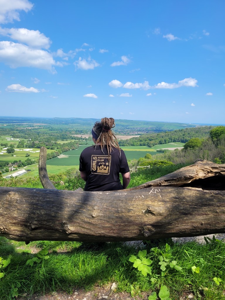
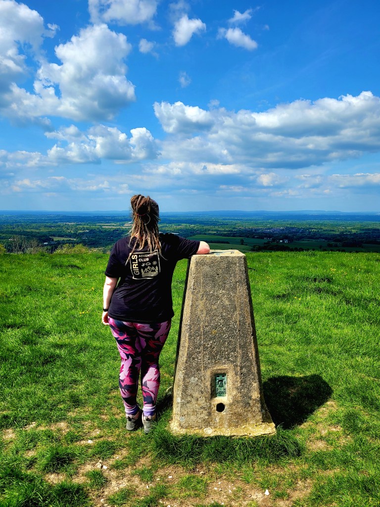
The starting point is the car park on Long Meadow (BN14 0HU) near Findon. The path up the grassy hillside is steep but clearly visible, and leads into the edges of woodland. There are some rough steps and rocks as you pass under the trees; keep following the path up to reach the hill fort of Cissbury Ring. As the name suggests, this circular monument sits on the top of the hill. Take the anti-clockwise direction to find the trig point, cutting across the centre of the ring.
Head back to the rim of the ring, continuing anti-clockwise until you reach the path heading north down the side of the hill. Here, the path will meet a narrow road and small car park. Cross straight over and continue north up a wide and clear gravel path.

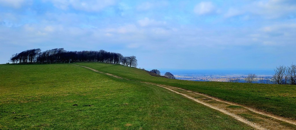
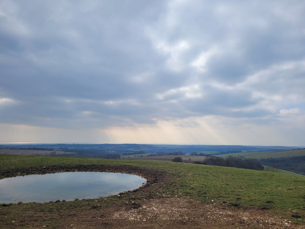
This path is a gentle incline, giving excellent views of the coast (Lancing and Shoreham, and Brighton on clear days), and following this for just over 3km will eventually intersect with the South Downs Way. The obvious ring of beech trees would have been visible from the walk up; go left on the South Downs Way for the last stretch up to the top of Chanctonbury Ring.
The views from the top of Chanctonbury Ring are impressive from all sides, but the route I took followed the curve of its southern ridge around to the west. This is a perfect spot to see the impressive display of Red Kites gliding on the thermals.
Head north just before the path splits to find the second trig point of this walk, which is where I chose to head back towards the beech trees and explore the area to find the all important view for a brew.
When you’re ready, you can explore the South Downs Way, or head back the way you came to Cissbury Ring.
Or, you can test local legend and run around the beech trees seven times. The devil is said to appear and offer you some soup – would you accept?
Full route map, elevation profile and link for the route on Strava below.


A lovely read, definitely got me thinking about dusting off my walking boots.
LikeLiked by 1 person
Thank you – it’s always time for an adventure!
LikeLike